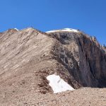
Mount Vercenik Winter Climbing | Kackar Mountains National Park
Finally, we had the chance to organize a winter expedition to this fascinating mountain. In February 2024, we were able to climb Mount Verçenik winter climbing, which had been my dream for two years. In those two years, I tried many times, but either I couldn’t find a partner or the conditions weren’t right to go. There was also a lack of information about the area because Verçenik Dağı is rarely climbed in winter and there have been few attempts. In fact, it would be a kind of exploratory climb for us. One of the things that made this climb so appealing to me was that it is rarely climbed in winter and no one had done it for a long time. Verçenik Dağı had been climbed only 4 times in winter, the last time in 2009 by Burak KURAL, Ercan ATAMAN and Kadir Ali ATACAN. We became the fifth team in February 2024. Vercenik Winter Climbing | Kackar Mountains National Park
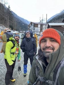
So how was this climb planned and how did the team come together? I had offered Fatih Yılmaz several times to go to Mount Verçenik winter climbing. Then, a few weeks before this climb, he called me and asked if we should go to Verçenik. I said why not. We followed the weather forecast but the conditions were not very favorable so we had to cancel. Later, when I was at the TDF Ice Climbing Refereeing Training in Trabzon, Fatih Yılmaz and Mustafa Kemal Karabulut were also at the training. On the last day of the training, Fatih abi asked if we should go to Verçenik and that’s how the plan started. Since the weather and snow conditions were also favorable, we decided to start the Verçenik winter activity on Tuesday, February 20th.
I will not be able to talk about what we did hour by hour in this report because I did not have the chance to take many notes, but I will try to explain what we did day by day, where we stayed and how we progressed. I hope someone else wants to try it and this report helps them
Tuesday, February 20, 2024
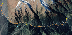
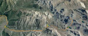
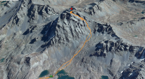
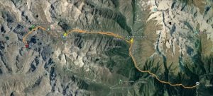
Topographic Map of the Route We Walked on Day 1 / 12 Km / White Arrows Show the Estimated Locations of Avalanches on the Route
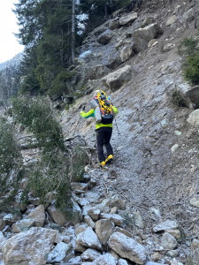
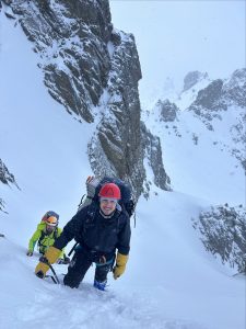
On Tuesday, February 20th, in the early hours of the morning at 4:00 am, Fatih picked us up from our homes and we headed to the Rize road. When we arrived in Çamlıhemşin, we gave the Gendarmerie information about the area we were going to and then continued towards Çat. We arrived in Çat at around 7:30 am and after making final adjustments to our bags, we started walking at 8:00 am. Our first goal was to reach Orta Yayla.
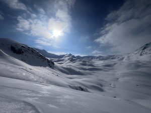
You are walking through an incredible valley; on your left is a stream and forest, and on your right are huge walls. You continue like this for a while. The snow conditions weren’t too bad as you walked through the Çat Valley – there was about 5 cm of snow on the ground and you were able to walk quickly. The cold morning air also kept the snow hard. After a few kilometers, you came across the first avalanche. You counted about 20 avalanches along this route, and Fatih abi marked the exact locations of the avalanches in the GPS while drawing the route on Wikiloc. I would say it was a very solid GPS recording. You can thank Fatih abi for that.
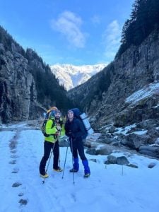
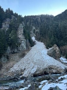
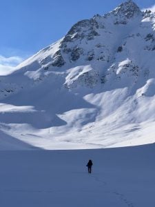
As we continued on the trail, we took our first break at the turnoff for Çiçekli Köyü (Flower Village). The road splits here. If you go left, you go to Çiçekli Köyü. If you continue straight on the right, you head towards Orta Yayla (Middle Plateau). Right at this point, we saw one of the biggest avalanches we have ever seen and crossed over it to continue on our way. We were able to reach Orta Yayla around 12:30 pm and looked for a house or hut where we could stay, but unfortunately we could not find a place open. So we set up camp in the valley 1 km away from Orta Yayla towards Verçenik Yaylası (Verçenik Plateau) and went into rest mode, getting ready for tomorrow morning.
Wednesday, February 21, 2024
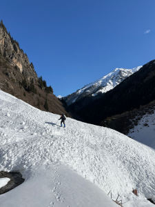
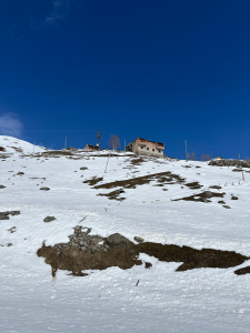
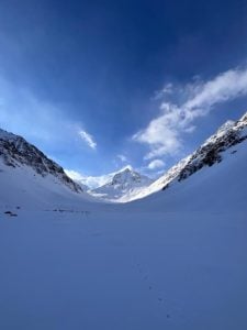
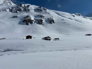
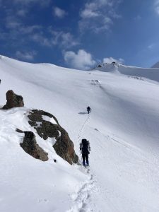
We started getting ready by waking up at 06.00 in the morning. After packing up the tent, we had a hot tea and some snacks, then began our 8 km journey towards Verçenik Plateau, our destination. As we advanced towards Verçenik Plateau, a mountain placed right in the middle of the valley meets you. You fall in love with its grandeur at first sight. This valley is a bit risky. On both your right and left, there are peaks over 3000 meters filled with avalanche tracks. While walking through this valley, we crossed over a few avalanches. The weather was very good again today, with almost no wind close to zero. By noon, we had reached Verçenik Plateau and looked for a house we could enter immediately. Luckily, we found one this time. The house had suffered some damage from the snow, with a broken window, but we still went inside. Fatih started preparing the meal while Mustafa Kemal went to fetch water from the stream.
Under normal circumstances, our plan was to stay at Verçenik Plateau and go to Kapılı Lakes Region the next day. However, since the weather and snow conditions were very good, we decided to climb up to Kapılı Lakes and set up our camp there. It required about a 4 km hike from Verçenik Plateau to Kapılı Lakes, where the snow was sinking slightly but our pace was very good. Towards the late afternoon, we arrived at Kapılı Lakes region, set up our tent, and switched to rest mode for the summit we would climb the following night
Thursday, February 22, 2024 (Summit Day)
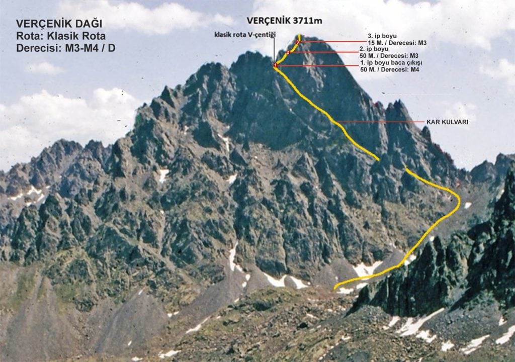
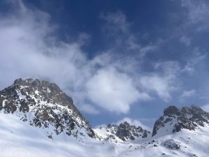
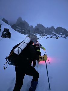
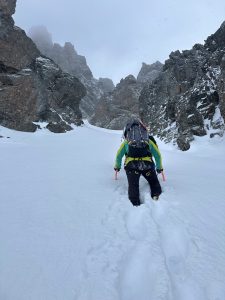
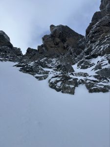
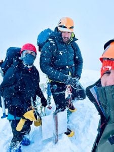
When we reached the Kapılı Lakes, we quickly set up our tent and settled in for the night. After having some hot water and snacks in the tent, we planned to start our summit assault at 04:00 in the morning. The night continued with snowfall and overcast weather. We woke up to the alarm on Fatih’s phone and his call, “Come on, guys!” After having some warm water, we quickly exited the tent and started walking towards the entrance of the couloir. The snowfall persisted lightly, and the snow was sinking. After a few hours, we reached the entrance of the couloir and quickly began ascending within it. We put on our ice axes, crampons, and safety harnesses on the flat part of the couloir and continued, reaching the notch of the V around noon. We took out the ropes from the bag, and Fatih was going to lead the first pitch; this was the stage where Verçenik’s famous chimney was located. Fatih Abi started climbing the chimney slowly, while I was belaying him.
Let me describe the condition inside the chimney in winter: The snow had lightly filled the inside of the chimney, with some places having small patches of ice, but generally, you’re climbing through a mix of powdery snow and rock. You can’t find most of the pitons and existing perlon cords because the snow has covered them. We could only see a few pitons.
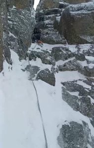
Fatih Abi got stuck at around 35-40 meters. It was a vertical passage of 2-3 meters, with scarce points to hold onto with your hands or ice axe. Fatih Abi struggled for about one and a half to two hours at that point, while Kemal and I were freezing down below . Fatih Abi was quite tired at that point and told us through the radio that he couldn’t proceed beyond that point and asked if I could. I said I could if he would take us there, but there wasn’t much space to set up many anchors, so we stood by, encouraging and motivating him as much as possible. Kemal and I supported Fatih Abi to make it through that section in a few moves. After climbing another 10 meters, he set up the anchor and brought us up. Fatih Abi had struggled a lot on this pitch and had even frozen his left pinky finger; it had started turning purple.
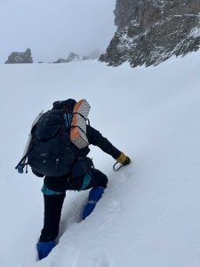
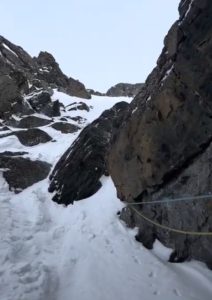
I was to lead the second pitch. Taking the gear from Fatih Abi, I started climbing the second pitch. Here, you can quickly pass through a small rocky passage at the beginning. Then, you try to ascend through plenty of snow. You need to be careful here; if you get too close to the left, there’s a cliff, and if you get too close to the right, there are rocks, making progress difficult. There aren’t many places to put intermediate protection here; you might be able to place some protection from the rocks on the right, but I chose not to. After climbing about 50-55 meters, I set up the anchor at two pitons.
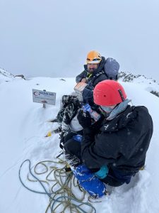
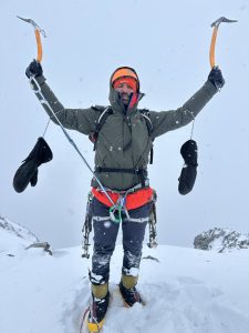
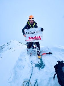
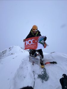
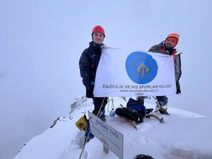
Normally, there should be pitons and bolts in the area I climbed, but since they were covered in snow, I couldn’t find them. After quickly bringing Fatih Abi and Kemal up, we realized we were getting closer to the summit. Fatih Abi led the third pitch. After passing through a steep 3-4 meter rocky passage, we climbed about 10-15 meters in deep snow and set up an anchor from a rock horn to bring us up. As we approached the last 20 meters to the summit, Fatih Abi secured our safety, and we climbed the final stretch, reaching the summit around 16:00.
After spending 10-15 minutes at the summit, we quickly began our descent as we wanted to descend from the chimney before it got dark. The wind and snow had intensified, and as darkness approached, we descended through the couloir beneath the chimney and quickly made our way down, reaching the tent around 20:20 in the evening, switching to relaxation mode. The entire ascent and descent took us 15 hours.
Friday, January 23, 2024
We woke up at 7:00 AM in our campsite at Kapılı Göller and packed up our tents. We started hiking at around 8:30 AM. Our goal was to reach our car in Çat Köyü. We had to walk approximately 52 kilometers. First, we descended to Verçenik Yaylası. We had a hearty lunch there because we hadn’t eaten in almost 2 days. After Verçenik Yaylası, we descended to Orta Yayla and picked up the gifts we had left there. Then, we continued towards Çat Köyü. We finally reached Çat Köyü at around 7:00 PM. We were a very harmonious team throughout the activity. I would like to thank my friends Fatih Yılmaz and Mustafa Kemal Karabulut for their support along the way.
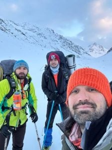
Team:
- Fatih Yılmaz
- Mustafa Kemal Karabulut
- Cemre Demiröz
Dates:
- February 20-23, 2024
Summit Date:
- February 22, 2024
Route:
- Classic Route
Elevation:
- 3711m
Type:
- Snow / Ice / Rock
Campsite:
- Orta Yayla / Kapılı Göller
Total Summit Time:
- 15 Hours
Total Distance:
- 52 km
Equipment:
- Twin Rope
- Ice Screws
- Snow Stake
- Chock Set
- Friend Set
- Carabiner
- Express Set
- Perlon
- Axe and Crampons
Wikiloc Recording:
- Wikiloc | Verçenik Kış Tırmanışı rotası (Mount Vercenik Winter Climbing trail) – Çatköy, Rize (Türkiye)- GPS track (I would like to thank Fatih Yılmaz for this recording.)
You can follow the current weather conditions for Mount Vercenik this site.
The mountain of the mountains, Mount Ararat may also interest you. Please click to read.